A good day on the water rarely happens by accident, and when you plan a fishing trip with GPS you remove much of the guesswork. GPS and charts let you study the water before you launch, choose areas worth fishing, mark launch ramps and hazards, build routes between spots and set a return plan. The result is less time wandering, more time fishing and a safer trip. This guide gives you a step-by-step method: choosing the water and the target, studying charts, creating waypoints and routes, checking weather and tides, preparing your boat and electronics, sharing a float plan, and reviewing the trip afterwards so each outing improves the next.

Plan a fishing trip with GPS: set your goal
Decide what you want
Choose your target species, the technique and how long you can fish. A clear goal guides every other choice.
Pick the water
Choose a lake, river or stretch of coast based on season, access and your experience.
Consider the season
Fish move through the year, so consider spring, summer, autumn or winter patterns. See our guides to summer bass fishing with sonar and winter fishing with sonar.
Study the chart
Find structure
Look for points, humps, ledges, channels and creek mouths. See our how to read nautical charts guide.
Spot hazards and access
Note shallow areas, rocks, bridges and ramps.
Choose several candidates
Pick three to five spots rather than one, so that you have options if conditions change.
Create waypoints and routes
Mark the launch and hazards
Mark the ramp, safe channels and hazards first. See our marine GPS waypoints guide.
Mark fishing candidates
Add waypoints for each target spot, and name them clearly.
Build a route
Link waypoints in a sensible order that minimises travel and avoids hazards. A route lets your GPS guide you from spot to spot.
Plan an exit
Mark a safe route home and an alternate ramp.
Check weather, tides and water levels
Weather forecast
Check wind, waves, storms and temperature, and check again before launching.
Tides and currents
In tidal water, plan around tides. See our tides and currents guide.
Water level and clarity
Check recent rain and releases, since they affect river and lake conditions.
Set go and no-go limits
Decide in advance the conditions in which you will not go, or will turn back.

Prepare your boat and electronics
Test devices at home
Charge batteries, update software and charts and check that your fish finder and GPS work. See our maintenance guide.
Pack safety gear
Life jackets, a first aid kit, lights and communication gear matter. See our boat navigation safety basics and boat launch checklist.
Carry backups
A handheld GPS, a compass and spare batteries are valuable. See our handheld GPS guide.
Load routes and waypoints
Make sure your plan is saved on the device you will use.
File a float plan
Tell someone
Share where you are going, who is with you, what boat you have and when you expect to return.
Include contact details
Give a phone number and instructions on whom to call if you do not return.
Update if plans change
If you change your route or delay your return, let someone know.
On the water: follow the plan, but stay flexible
Start with the best candidate
Go to the first spot, check sonar and decide whether to fish it. See our how to find fish with a fish finder guide.
Use the route and track
Follow your route and watch your track to avoid retracing the same water.
Mark new finds
Add waypoints for new discoveries and hazards.
Adapt to conditions
If wind or fish behaviour changes, switch to an alternate spot.
Review after the trip
Clean your waypoints
Delete weak marks, rename good ones and add notes.
Record what worked
Note conditions, lures, depth and results. See our fishing journal guide.
Back up your data
Save waypoints to a card or computer.
Plan the next trip
Use what you learned to refine your list.
Common mistakes
- Planning only one spot.
- Ignoring weather and tide.
- Not marking hazards.
- Skipping a float plan.
- Never reviewing the trip.
A sample plan for a Saturday morning
Suppose you fish a 2,000-acre lake for bass. On Thursday evening, you open the chart and mark the ramp, two creek mouths, a long point and a hump. You note that the hump tops out in a depth you like for the season. You build a route from the ramp to the point, the hump and the creek mouth, and mark a shallow bar between the point and the hump as a hazard. On Friday, you check the forecast and tell a friend your plan. On Saturday, you launch early, run to the point, scan with sonar and begin fishing. At midday, wind picks up, so you move to the sheltered creek mouth. In the afternoon, you return by the route you planned. Afterwards, you note which spots produced and update your waypoints.
Keep a template for repeat trips
Once you have a good plan, save it as a template. Copy the route and waypoints for similar trips, and adjust for season and conditions. A template saves time and keeps you consistent.
Share plans with fishing partners
Sharing your route and waypoints with a regular partner helps both of you prepare, and ensures someone else knows where you are. Agree on a plan for what to do if you get separated.
Technology tips for trip planning
Use whichever tools you prefer. Many anglers plan on a computer or tablet with a large screen, then transfer waypoints and routes to a chartplotter or fish finder. Check how your device imports data, and test the transfer at home. Keep a backup of your plan on a phone, and print a simple paper version with the key waypoints and a map. If you rely on cellular data for maps, download offline versions first, since coverage can be poor on the water.
Frequently asked questions
Do I need a chartplotter to plan trips?
It helps, but you can plan with a fish finder with GPS or a handheld GPS.
How many waypoints should I create?
Enough to cover your plan, but not so many that the list becomes cluttered.
Can I plan a trip on my phone?
Yes, many anglers plan on a phone or computer and transfer waypoints.
What if conditions change?
Use your alternate spots or head home safely.
Make every trip count
When you plan a fishing trip with GPS, you combine knowledge, preparation and safety into one routine. Study the chart, mark your waypoints, check conditions, share your plan and review afterwards. Browse GPS-equipped fish finders and chartplotters in our shop and contact us for help choosing equipment.
Related reading from Fishtrail Outfitters
- Marine Electronics Setup Guide: Plan a Complete Boat Electronics System
- Tournament Fishing Electronics: Prepare Your Sonar, GPS and Power
- Keep a Fishing Journal with GPS Waypoints and Photos
- Save Fuel and Time on the Water with GPS and Sonar
Products mentioned in this guide
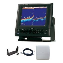
- Fishfinder Furuno FCV 600
- Fishfinder Furuno FCV 800
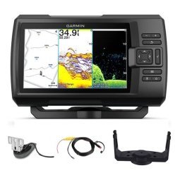
- Lowrance Eagle 5 CHIRP Splitshot Gps Fishfinder + 455/800 KHz Transducer
Further reading: U.S. Coast Guard Navigation Center · Take Me Fishing: how to get started and where to fish
Questions before you buy? Contact Fishtrail Outfitters or browse the shop.