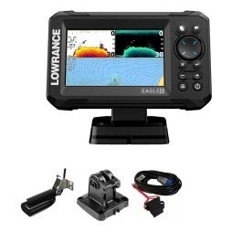
Fish often hold at a particular depth, and contour trolling with GPS is the method that lets you keep a lure at that depth mile after mile. A contour is a line on a chart connecting points of equal depth, and by steering along one, you stay over water that is the same depth, which often means the same type of fish habitat. Without GPS this is difficult, because you cannot see the contour from the surface; with GPS, charts and sonar, it becomes a steady, repeatable skill. This guide explains how contours work, how to choose which line to follow, how to set up your chartplotter and sonar, how to control speed and turns, and how to adjust when fish are not where you expected.

Contour trolling with GPS: what it is and why it works
A contour follows a constant depth around points, humps and channels.
Fish relate to depth
Many species prefer a certain depth range depending on season, temperature, oxygen and food. By following a contour, you keep your lure within that range for longer than a random pass would.
Contours connect structure
Contours wrap around points, flats and humps, so following one visits many features without leaving the productive depth.
Efficient coverage
Trolling covers a lot of water. Combined with a contour, it covers the right water. Our trolling with a fish finder guide explains the broader method.
Choose which contour to follow
Start with your target depth
Pick a depth based on season, water temperature and species. In summer, deeper contours near the thermocline may produce. In spring, shallow contours near spawning areas may do better. See our thermocline fish finder guide and fishing drop offs guide.
Look for features on the contour
Points, bends and humps along a contour often hold fish. Mark them as waypoints.
Consider wind and current
Wind-blown contours can concentrate bait, and current may affect your lure speed and depth.
Set up your chartplotter
Use detailed lake maps
A detailed chart shows contour lines clearly. If your unit supports extra charts for your lake, they greatly improve contour trolling. Our chartplotter buying guide discusses chart options.
Choose the right screen layout
Use a split screen with the chart and sonar, and show speed and depth. Save the layout.
Turn on the track
A visible track shows where you have trolled and helps you stay on the line.
Zoom appropriately
A zoomed chart makes it easier to see small deviations.
Hold the contour
Steer by the chart, confirm with sonar
Watch the chart for the line and the sonar for actual depth. If the two disagree, trust the sonar and adjust.
Make small corrections
Gentle turns keep lines straight and maintain depth. Avoid sharp turns that tangle lines.
Use autopilot if available
Some boats use an autopilot to hold a line. Check your equipment.
Watch for depth changes
A depth alarm helps you avoid shallow hazards.
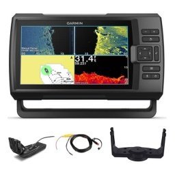
Control speed and lure depth
Use GPS speed
Hold a steady speed over ground and adjust for current. See our fish finder with GPS guide.
Match line out to depth
Use sonar to verify the depth of your lures, adjusting line out, weight or downrigger depth to stay in the fish zone.
Change speed to find the trigger
Vary speed slowly until fish respond.
Use sonar to refine the pass
Look for bait and fish
When you see marks at a specific depth, adjust lures to that level. Our baitfish on a fish finder guide helps you interpret them.
Mark productive spots
Mark waypoints where bites occur and return to them. See our marine GPS waypoints guide.
Switch contours
If a depth is not producing, try another contour a few feet deeper or shallower.
Contour trolling in different waters
Reservoirs and big lakes
Contours around points and humps are especially productive.
Natural lakes
Look for shelves and basin edges.
Coastal waters
Use depth lines along reefs and channels. See our offshore fishing electronics guide.
Safety and etiquette
- Watch for shallow water and obstructions.
- Respect other boats and lines.
- Keep rods and lines away from the propeller.
- Use lights at night.
See our boat navigation safety basics.
Common mistakes
- Following a contour too closely and hitting shallow water.
- Not checking sonar against the chart.
- Turning too sharply.
- Staying on a barren contour too long.
- Ignoring bait.
A sample contour-trolling day
Start with a chart of your lake and mark two or three contours at likely depths, perhaps one shallow and one deep. At the first contour, set your speed and let out lines to a depth that matches your target. Follow the line for ten minutes, watching sonar and the chart. If you see bait or fish, note the depth and adjust lures. If nothing appears, move to the second contour and repeat. When a bite occurs, mark it, then make a wide turn and repeat the pass over the same section. By afternoon, your track and waypoints show where the fish were, and you can focus on the sections that produced.
Use your results the next time
Back at home, review the track and waypoints on your computer or screen. Note which contours, depths and speeds worked, and how conditions affected the bite. These notes shorten your search on your next trip.
Combine contours with structure
The best contours are often those with a feature on them, such as a hump, an inside bend or a bait-holding point. Plan your route to pass over several features along a single contour, and you maximise the chance that the lure meets a feeding fish.
Equipment that makes contour trolling easier
A fish finder with GPS and good lake charts is the heart of the system. Add a stable power supply, a clean transducer and a well-placed screen. If you troll often, consider a unit with a fast chart redraw, so the line moves smoothly as you steer. A second display, or a split screen, lets you watch the chart and sonar together. And remember good basic gear such as a tidy rod holder layout and a reliable trolling motor or main engine for steady speed. These details matter more than extra features you will rarely use.
Know when to leave a contour
If you have trolled a contour for a long stretch with no bites and no marks, change something. Move deeper or shallower, shift to a contour with more structure or switch lures. The beauty of a GPS track is that you can see exactly where you have covered, so you can leave with confidence.
Frequently asked questions
Do I need a detailed chart?
It helps a lot, but you can still follow depth with sonar alone.
Can I troll a contour without GPS?
It is harder, because you cannot see your position. Sonar can help.
What speed should I troll?
Use a speed that suits your lures and species, and adjust.
How do I stay on the line?
Use small corrections and check the chart and sonar often.
Follow the line to the fish
Contour trolling with GPS combines charts, sonar and steady boat control into a method that finds and keeps fish. Choose your depth, follow the line and mark what works. Browse GPS units and fish finders in our shop and contact us for help choosing the right equipment.
Related reading from Fishtrail Outfitters
- Fishing Drop Offs and Ledges With Sonar: Find Fish on the Edge
- Trolling With a Fish Finder: Use Sonar and GPS to Troll Smarter
- Fish Finder Chartplotter Combo: Is an All-in-One Unit Right for You?
- Garmin Marine GPS Guide: Choosing a Garmin Chartplotter or Fish Finder
Products mentioned in this guide
- Fishfinder Furuno FCV 600
- Fishfinder Furuno FCV 800
- Lowrance Eagle 5 CHIRP Splitshot Gps Fishfinder + 455/800 KHz Transducer
Further reading: U.S. Coast Guard Navigation Center · Take Me Fishing: how to get started and where to fish
Questions before you buy? Contact Fishtrail Outfitters or browse the shop.