
Boat navigation safety is not about one gadget. It is a set of habits that together keep you, your passengers and your boat out of trouble: planning before you leave, knowing where you are, watching what lies ahead and having a backup when electronics fail. A modern GPS or chartplotter is a powerful aid to all of these, but it is never a substitute for a lookout, good judgement and preparation. This guide explains the basics of safe navigation for anglers and recreational boaters, how to use charts and GPS wisely, which backups to carry and which common mistakes to avoid, so that every trip ends at the dock as planned.
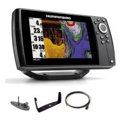
Boat navigation safety starts with planning before you leave the dock
Safe trips begin on land. A few minutes of planning prevents most of the problems that cause incidents on the water.
Check the weather and water conditions
Look at the forecast for wind, waves, storms and visibility, and check conditions again before you launch. If the forecast changes during the day, be ready to change your plans. Wind against current or tide can build rough water quickly, so take it seriously.
Plan your route and your turnaround
Choose where you will go, how you will get there and when you will head back. Look at the chart for shallow areas, submerged hazards and restricted zones. Our guide to planning a fishing trip with GPS shows how to create a route and mark key points.
Tell someone your plan
Share your route and expected return time with someone ashore. If you do not return, they know where to start looking.
Check your equipment
Confirm fuel, battery charge, lights, life jackets and communication gear before you leave. A short checklist saves you from discovering a problem when you are far from help. Our boat launch and trailering checklist is a good starting point.
Know where you are: using GPS well
A GPS or chartplotter tells you your position, speed and heading. It becomes a safety tool when you use it consistently.
Watch your position against the chart
Look at the chart regularly and compare it with what you see around you. When the two match, you can trust the unit. When they differ, stop and work out why.
Use waypoints for safe points
Mark your launch, safe channels and any hazards you find. Our marine GPS waypoints guide explains the techniques.
Set alarms
Many units can alert you to shallow water, off-course drift or arrival. Alarms act as a second pair of eyes, particularly in low light. See our guide to GPS anchor alarms as well.
Keep software and charts current
Charts and software change as the water does. Update them regularly and treat old charts with extra caution.
Understand charts and markers
A chart is a map of the water, and it has its own language.
Depth and hazards
Depth contours show how deep the water is, and symbols show rocks, wrecks and other hazards. Learn the colours and symbols used on your charts. Our guide to reading nautical charts is a good place to begin.
Buoys and markers
Buoys and markers guide you along channels and warn of hazards. Learn the system used where you boat, and match what you see with what the chart shows.
Tides and currents
If you boat in tidal water, check the times and heights of tides and the strength of currents. They change depth, speed and conditions. Read our guide to tides and currents for anglers.
Keep a proper lookout
No electronic device replaces your eyes and ears.
Look up often
Check ahead, behind and to each side at regular intervals. Do not get absorbed in the screen. If you need to adjust settings, slow down or stop.
Use all your senses
Listen for horns, engines and breaking waves, and watch for changes in water colour and surface texture that suggest shallow water.
Assign a lookout
When you have passengers, ask one of them to help watch for hazards and other boats, especially at speed or at night.
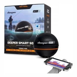
Carry backups for your electronics
Electronics fail, and a good plan assumes they might.
A compass and a paper chart
A simple magnetic compass and a paper chart of your area are reliable even when power is lost. Our marine compass and backup navigation guide explains how to carry and use them.
A handheld GPS or phone
A handheld GPS, or a phone with a waterproof case and a navigation app, offers a second source of position. Keep it charged.
Spare power
Carry a spare battery or power bank for portable devices, and make sure the main battery is in good condition.
Communication
A VHF radio, a charged phone and a whistle make it easier to call for help. See our VHF radio basics guide.
Lights, visibility and night boating
Visibility problems account for many accidents.
Navigation lights
Make sure your lights work and are correct for your boat. Our navigation lights and night boating rules guide goes into detail.
Reduced visibility
In fog, rain or darkness, slow down, use your GPS and chart, listen carefully and stay in known channels. See our boating in fog tips.
Be seen
Wear bright clothing and carry a spotlight or flashlight. A reflective strip on life jackets helps rescuers find you.
Safety gear that belongs on every boat
Safety equipment works only if it is on board and accessible.
- Properly fitted life jackets for every person.
- A throwable flotation device.
- A fire extinguisher suitable for your boat.
- A first aid kit.
- A signalling device such as a whistle or horn.
- An anchor and enough line.
- A bailer or bilge pump.
Check the rules where you boat, because requirements vary.
Common navigation mistakes
- Trusting a screen without looking outside.
- Using outdated charts.
- Ignoring weather changes.
- Leaving without a float plan.
- Forgetting a backup compass or battery.

Navigation safety for different kinds of boating
The same principles apply to every boat, but the emphasis shifts with the kind of trip.
Small boats and kayaks
Small craft sit low, have limited range and are easily affected by wind and waves. Keep trips short and close to shore, carry a waterproof phone case and a whistle, and pay close attention to the forecast. Our guide to marine electronics for small boats suggests sensible equipment for compact craft.
Fishing boats on lakes and rivers
Inland water hides stumps, shallow bars and changing water levels. A chartplotter with good lake charts, combined with sonar, shows both the planned hazards and the changes that surveys missed. Slow down in unfamiliar water and run your depth alarm.
Coastal and offshore trips
Longer trips add distance from help and greater consequences for mistakes. Leave a float plan, carry a VHF radio and monitor the weather. Our offshore fishing electronics guide explains how to equip a boat for bigger water.
Teaching passengers the basics
Safety is easier when everyone on board knows the essentials. Before you leave, show passengers where life jackets are stored, how to put them on and where the fire extinguisher and first aid kit sit. Explain how to call for help and how to operate the radio if you become unable to. Make sure at least one other person can stop the boat and steer back towards the ramp. A short briefing takes two minutes and gives everyone confidence, and it can make an enormous difference if something goes wrong.
Frequently asked questions
Can I rely entirely on GPS for navigation?
No. GPS is a powerful aid, but you also need charts, a compass, a lookout and good judgement.
How often should I update charts?
Check before each season and whenever your unit prompts you.
What should I do if my GPS fails?
Slow down, use your compass and paper chart, and return by a known route. Call for help if needed.
Do I need a VHF radio?
Many boaters carry one because it allows direct contact with other vessels and rescue services. Check local rules.
Staying safe on every trip
Strong boat navigation safety comes from layers: planning, accurate electronics, a good lookout, backups and the right gear. Build these habits and they become automatic. Browse GPS units and chartplotters in our shop, and contact us if you would like help choosing equipment to support safer boating.
Related reading from Fishtrail Outfitters
- Boating in Fog: Navigation Tips Using GPS, Radar Alternatives and Common Sense
- Sailboat and Cruiser Electronics Basics: Depth, GPS and Backup Navigation
- Night Fishing Electronics: Use Sonar, GPS and Lights Safely
- Marine Compass Backup Navigation: What to Carry When Electronics Fail
Products mentioned in this guide
- Fishfinder Furuno FCV 600
- Fishfinder Furuno FCV 800
- Lowrance Eagle 5 CHIRP Splitshot Gps Fishfinder + 455/800 KHz Transducer
Further reading: U.S. Coast Guard Navigation Center · U.S. Coast Guard boating safety resources
Questions before you buy? Contact Fishtrail Outfitters or browse the shop.

